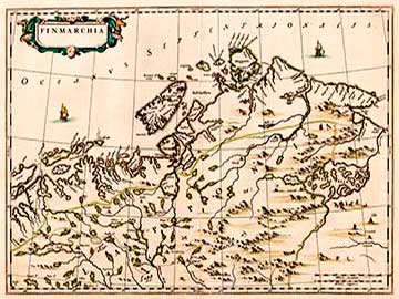
FINMARCHIA 1662 |
|
|
LAPPONIA 1662 |
|

|
|
When depicting Scandinavia Joan Blaeu (1596-1673), the name of which was the main reason for the Blaeu's publishing houses maps being so well known, mainly used Anders Bure's map material. The Blaeu family managed a successful map-publishing house in Amsterdam. The father of the two brothers Willem Janszoon Blaeu (1571-1638) had studied cartography in his youth under tuition of the Dane Tycho Brahe. Anders Bure (1571-1646), also known as Andreas Bureus or Bureaus, was the founder and developer of Swedish land surveying and cartography. Swedish issues of supremacy and frontier disputes with the neighbouring countries created the necessity for useful maps. Carl IX issued an order in 1603 for the commissioning of a map covering the whole of Scandinavia with Kustaa Adolf supporting the project rather generously. Bure's expansive Orbis Arctoi Nova Et Accurata Delineatio Auctore Andrea Bureo Sueco from 1626 long remained the model and basis for all maps representing the Nordic nations. Bure based his calculations on the doctrines and principles of Gerhard Mercator. His work Orbis Arctoi Imprimisque Regni Sueciae Descriptio, in English the Depiction of the Nordic Countries (1985), has been included as his introduction to the atlas illustrating knowledge on the area. |
|
1666
|